


Day 4-8 Graphical Outlook
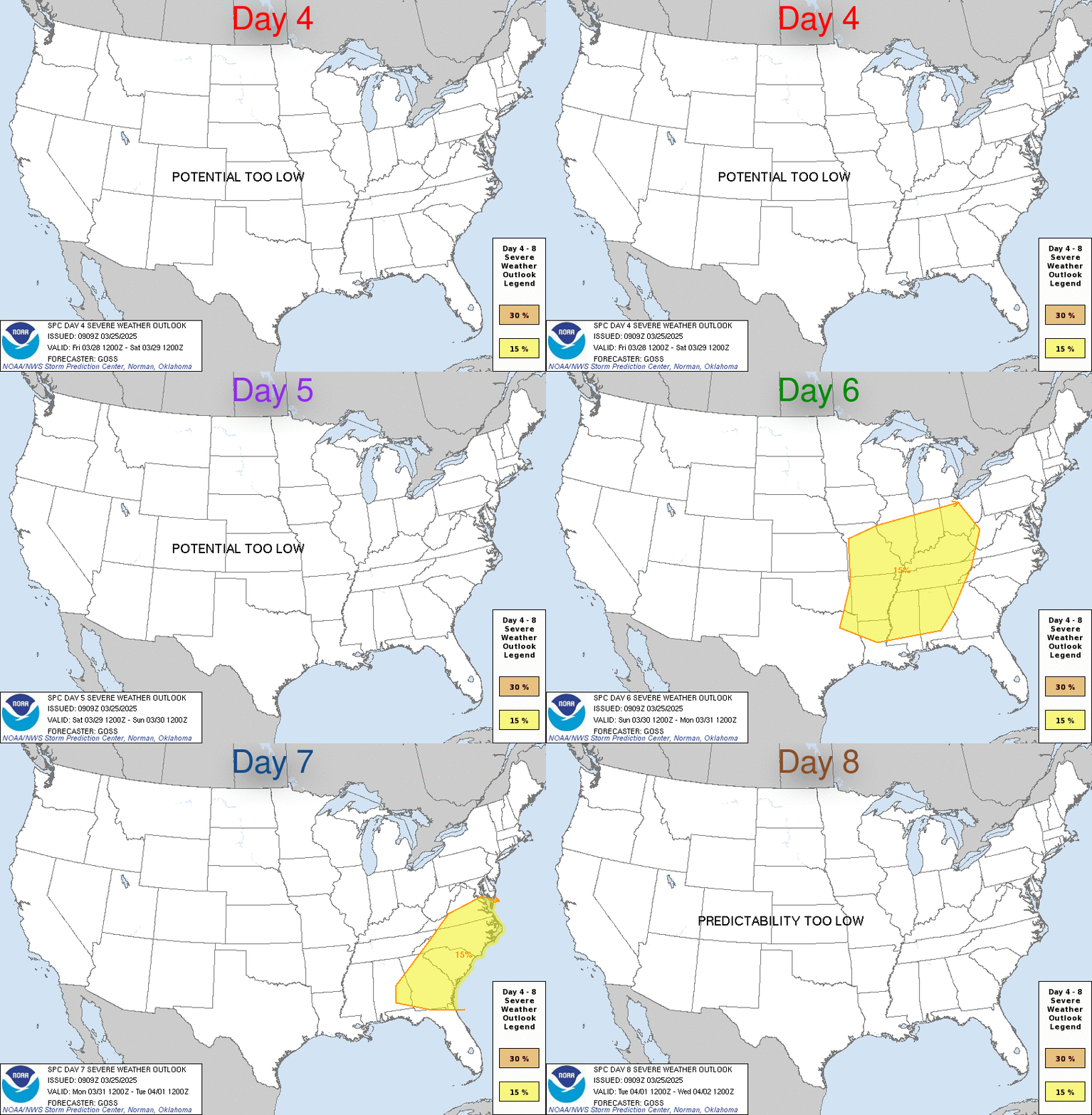
This outlook consists of probabilistic forecasts depicting the severe weather threat with a separate graphic for each day (D4, D5, D6, D7, D8).
- Probabilistic Thresholds: Two thresholds of 15% and 30% can be forecast.
- Equivalency: Highlighted areas are equivalent to the 2-SLGT (Yellow) or 3-ENH (Orange) risks seen on the Day 1–3 outlooks.
- Headlines: On rare occasions, the outlook text will begin with a headline for the possibility of a severe weather outbreak.
No 15% Area Phrases
If no 15% areas are forecast, one of the following two phrases will be used:
PREDICTABILITY TOO LOW: Used when severe storms may be possible, but the location or occurrence is in doubt due to large spread forecast scenarios.
POTENTIAL TOO LOW: Used when 15% or greater severe probabilities appear highly unlikely on that day.
 Day 3 Outlook
Day 4-8 Outlook Discussion
ZCZC SPCSWOD48 ALL
   ACUS48 KWNS 100820
   SPC AC 100820

   Day 4-8 Convective Outlook
   NWS Storm Prediction Center Norman OK
   0320 AM CDT Sat Oct 10 2026

   Valid 131200Z - 181200Z

   ...DISCUSSION...
   The 00Z models have slowed the progression of an upper low and
   associated trough from the Great Basin into the central Rockies on
   Days 4 and 5/Tuesday and Wednesday. By Day 6/Thursday and beyond,
   model spread increases in the handling of that midlevel system,
   leading to greater uncertainty in the evolution of the large-scale
   pattern.

   ...Day 4/Tuesday...

   There is some model signal that a subtle disturbance embedded within
   a belt of enhanced mid/upper-level flow will progress from the
   southern Rockies into the central High Plains, aiding in the
   deepening of a lee cyclone over southeast CO. Elsewhere, a
   low-amplitude disturbance is forecast to advance from the Great
   Lakes into the Northeast, in tandem with another surface low. A
   frontal system will connect the two lows, stretching from the lower
   Great Lakes through the OH Valley into the central Plains. A dryline
   will extend south from the lee cyclone to along the TX-NM border. A
   moist and unstable air mass will reside south of the front,
   especially over the central and southern Plains, where richer
   boundary-layer moisture is expected to reside.

   Isolated severe storms appear possible along the front Tuesday
   afternoon and evening, especially in the Northeast, and from the
   lower-MO Valley into the central and southern Plains. The most
   probable location for organized severe storm potential is over the
   southern High Plains in the vicinity of the lee cyclone and
   strengthening low-level jet where stronger forcing for ascent and
   vertical shear will coincide with a moderately unstable air mass.


   ...Day 5/Wednesday...

   The slowing of the upper-air system and the potential for
   thunderstorms Tuesday night into Wednesday morning lead to greater
   uncertainty in where the strongest instability will develop by
   afternoon. Isolated severe storms appear possible along and south of
   a surface front from the southern Mid-Atlantic into the central and
   southern Plains. However, confidence in delineating an area of more
   concentrated severe weather potential has diminished. And as such,
   the previously included 15% contour will be removed for this
   forecast update.


   ...Days 6 through 8/Thursday through Saturday...

   As alluded to above, spread increases across the models (especially
   the deterministic solutions) in the handling of the central Rockies
   low/trough. However, the general signal is for a trend toward a
   less-favorable synoptic pattern for severe storms by next weekend.

   ..Mead.. 10/10/2026

   CLICK TO GET WUUS48 PTSD48 PRODUCT
Storm Prediction Center
- Latest Mesoscale Discussions
- Soundings Climatology
- Day 1 Convective Outlook Discussion
- Day 2 Convective Outlook Discussion
- Day 3 Convective Outlook Discussion
- Day 4-8 Outlook Discussion
- SREF Short Range Ensemble
- SPC Composite Image Map
- Day 1 Fire Weather Outlook Discussion
- Day 2 Fire Weather Outlook Discussion
- Daily Storm Reports
- Hourly Mesoscale Analysis Archive
- Tornado Summary
- Public Severe Weather Outlook Discussion
- Meso Analysis Map
- Latest NWS Admin Message
Weather Prediction Center
Storm Prediction Ctr Facebook Feed
Never base important decisions on this or any weather information obtained from the Internet.
Always have a backup method of receiving weather information such as a battery powered weather radio.
Copyright © 2026 DaculaWeather.com
